Pretty (And Informative): Map Breaks Down Boroughs By Their Streets, Avenues and Roads
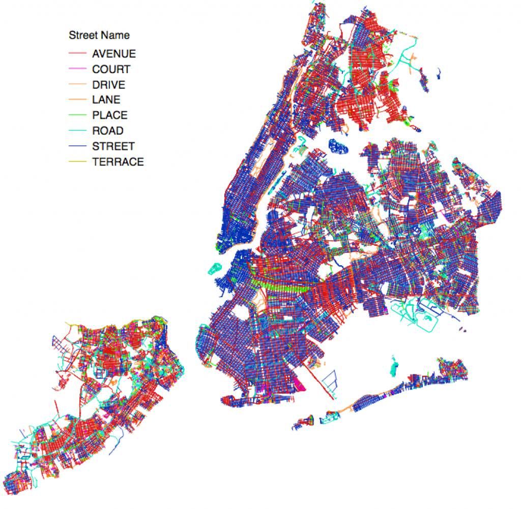
Image: I Quant NY
New York City must be a statistician’s dream. Our little microcosm is just teeming with data, isn’t it?
In their ongoing mission to break city life down into digestible data, the folks at I Quant NY put together a handy map organizing NYC roadways by their suffixes (i.e. avenue, road, street, place) and came up with the map from above.
Here are few fun things we learned:
- Manhattan is a “street” lovers’ borough as anyone with a brain knows. In fact, streets make up nearly 70 percent of Manhattan, followed closely by “avenues” and “places.”
- By percentage, the Bronx has more avenues than any other borough. By number alone, Staten Island claims that title. They fancy, huh?
- When it comes to “roads,” Queens dominates with nearly 20 percent of the borough’s roadways bearing the suffix.
- Brooklyn has a lot of streets, of course, but when we say “avenue,” we really mean it. Our avenues tend to cross huge swaths of the borough. Oh, and we have a weird collection of “places” in North Brooklyn.
- Staten Island simply doesn’t discriminate when it comes to naming roadways.
For a closer look at all this sexy data, head over to I Quant NY.
Follow Nikita Richardson on Twitter @nikitarbk