Here is an Illustrated Map of Every Crime in Brooklyn
There have been a lot of highly specific maps around these parts lately. Maps of gentrification, maps of noise complaints, maps of poop complaints, this glorious map of dog demographics. Turns out, publicly available data and nerds with time on their hands make great, internet-friendly bedfellows.
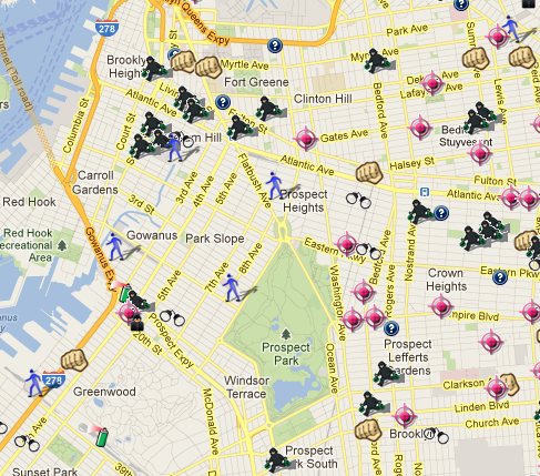
Now, in arguably more useful news (or news that will feed your worst, most crippling paranoia), we have a handy map of Brooklyn crime data, complete with illustrated icons tailored to crime categories — a fist for assault, a pink target for shootings, a spray paint can for vandalism, an adorable Monopoly-looking man with bags of cash to symbolize a robbery.
It’s almost cute enough to make you forget about, you know, the actual crimes, until you click on the individual details of a given incident. Then it gets sobering pretty fast. Technically, the SpotCrime map works for areas across the country, as well — information is pulled from both police and news reports — but why would we ever want to check in on crime anywhere else, when we can envision teeny tiny animated burglars, crawling into our very own windows? It’s a great way to spend the afternoon.
Follow Virginia K. Smith on Twitter @vksmith.