Welcome to 1940s Brooklyn
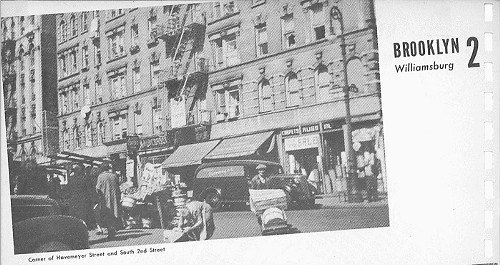
“In 1943, four local newspapers published a New York City Market Analysis. Largely forgotten in the 70 years since, the document provides an amazing window into New York’s neighborhoods of that era.” So begins the intro to a new website called 1940snewyork.com, a project of the Center for Urban Research at the CUNY Graduate Center, which scanned each page of this guide to NYC neighborhoods—based on the 1940 Census—and connected them to an interactive map. In Brooklyn, there are 28 neighborhoods in all, from Greenpoint to Coney Island, Bay Ridge to the old Highland Park.
See rare historic photos of your favorite neighborhoods, study old maps, and learn bygone demographic information: population totals, median rents, and ethnic make-ups. Also, learn strange facts, like, there used to be neighborhoods called Holy Cross, South Greenfield and English Kills.
Follow Henry Stewart on Twitter @henrycstewart