Do You Live in a Subway Desert? This Map Will Tell You
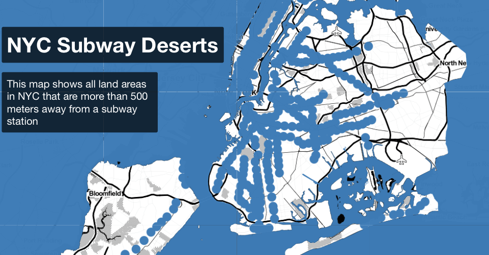
screenshot: NYC Subway Deserts/Chris Whong
Is your morning commute characterized by a long, arduous journey to the subway station? If so, you probably live in a subway desert—stretches of New York City that exist in a public transportation wasteland. If you happen to be one of these unlucky souls, well, you might find yourself in better company, because a new map made by a self-described “urbanist, mapmaker and data junkie,” named Chris Whong demonstrates that you’re not alone.
Whong defines “subway deserts” as places that are more than 500 meters (0.3 miles) from the nearest subway station. To illustrate the large swaths of transportation no man’s lands teeming across NYC, Whong plotted blue dots to pinpoint neighborhoods that sit within 500 meters of any subway station. The sections that exist on the map as untouched, white portions of land are your subway deserts. You’ll find that there’s a pretty sprawling desert spanning several neighborhoods in Brooklyn when looking at the borough’s place on the map. For example, much of Utica Avenue qualifies as a “subway desert.”
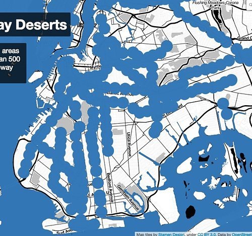
You’ll find that Whong’s blue dots largely mirror subway lines anyway, which for neighborhoods like Red Hook, are a known missing fixture of the daily commute. But, as the Atlantic’s City Lab points out, any anxiety about living in a transportation dead zone can be quickly allayed when taking into consideration New York’s myriad bus routes, which cover areas untouched by subway lines.
So even if Whong’s measly 0.3 mile stipulation sounds like an un-walkable hellscape to you (it’s probably because you’re lazy), you’ll always have options getting from point A to B in NYC. Even if the chronically broke MTA still has many, many trains that function on technology older than your great grandmother.
[via CityLab]
Follow Sam Blum on Twitter @Blumnessmonster