Rising Sea Levels Would Make Park Slope An Island
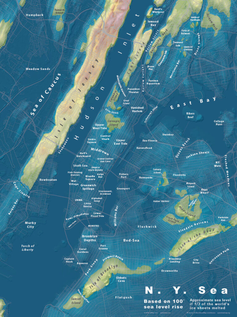
If you’ve watched enough disaster movies, you know that eventually most our beloved trash-infested boroughs is bound to be underwater, if rising sea levels and melting ice caps have anything to do with it. Ever wonder what the map of New York City would look like if sea levels actually did rise? Wonder no more: Urban planner and designer Jeffrey Lin has been making an extremely cool series of maps that suppose a hundred foot sea level rise. He’s done a bunch of cities, including Los Angeles, London, and Seattle, and he recently put up a rendering of what things would look like in our watery future.
As you can see, we’d pretty much have to say sayonara to Manhattan, and most of North Brooklyn. Also, so long Queens. But Sunset Park has a stronghold, as does Park Slope. In the event of disaster, I guess Park Slope would become even more of an island! (Ba-dum-chink.)
If the map intrigues you, Lin has them for sale on his website. pick one up and use it to terrify a climate change denier.
[H/T Brokelyn]