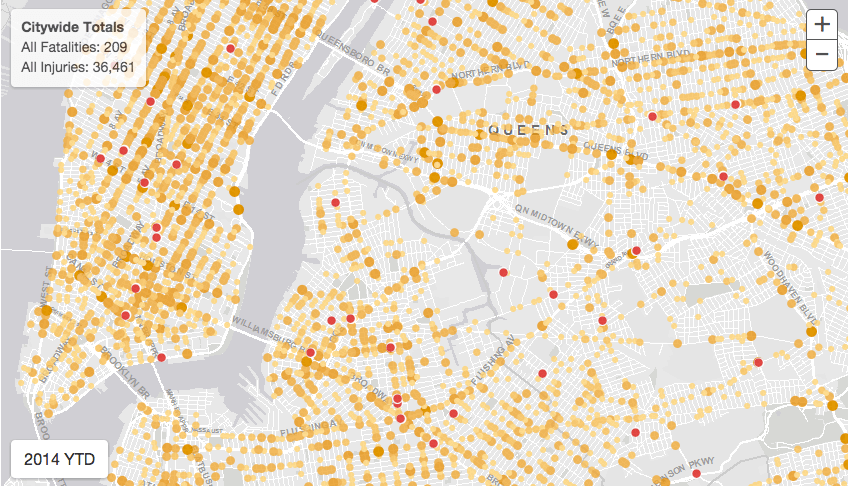
City Releases Traffic Fatality Map for Vision Zero Plan


Vision Zero is the city’s ambitious plan to eliminate all traffic-related fatalities by 2024, and now it has a handy, illustrated guide. This morning, the Department of Transportation launched Vision Zero View, a map that allows you to spot exactly where accidents that resulted in either injury or death occured around the city. It’s depressing! But also probably useful.
“To further advance the conversation, I am happy to announce that today the City is launching Vision Zero View, an online map that gives every resident access to timely information about the safety problem in their neighborhood, and what enforcement, design and outreach solutions the City is using to solve it,” DOT Commissioner Polly Trottenberg said this morning. “These are your streets, and now you have the information you need to help us attack this problem.”
To see how deadly your particular street corner is, click on through to the full map. You can filter it by year, by kind of accident (pedestrian or bicyclist related, say), and also by either injury or fatality. In 2014, the city has already had 209 fatalities and 36,461 injuries, so we’re a long way from that goal yet.
You might also like 


